Monday, July 6, 2026

About Old Gear Singletrack (mountain bike)

If you visit the msptrails.org page you will see a ride calendar for Twin Cities singletrack (mountain bike) group rides and a a link to a Messenger Chat Community for ride notifications and details.

One of the rides listed on the calendar is the "Old Gear Singletrack" (OGS) ride that I typically lead.  It's called "Old Gear" because these are daytime weekday rides and I'm old and retired.

For the OGS rides the calendar should always have the latest information - including cancelations for weather. Join the Messenger Chat Community for ride announcements, ride changes, and communication about rides.

Monday, March 2, 2026

All the group rides in the MSP metro area that an ai can find.

20 years ago, when the web was healthy, there would have been several web pages or blog that listed group rides in the MSP metro. Now that information is scattered across multiple sites like Facebook, Instagram, Reddit and more. Much of the information is siloed.

So what would once have been a quick Google search now requires a "pro" ai of extraordinary power. This is the report as of Mar 2 2026. (As is typical of modern ai I got a somewhat different response when I asked twice.)

PS. The second time I ran this query it uncovered a site that is current and has an extensive list and pulled things from there as well as other sources.

Sunday, August 10, 2025

South Minneapolis Tour 2025

I'm still refining this route, but here's the rough outline.

South Minneapolis Tour

  • Start at The Monument
  • Ford bridge
  • Lake Hiawatha then diagonal to Sibley park at 19th ave and 40th street, take the alley way at north end of park to go west past Longfellow to Cedar then north Duck Duck
  • From Duck Duck head west towards 15h ave and 35th street then go around Powderhorn then go further west to Chicago. Now head south on Chicago to George Floyd Square at Chicago and 38th street.
  • Take 38th street towards river 
  • OPTION: at 37th Ave head  north to 35th street and visit Longfellow Park
  • Take 35th street (or anything 35-38th street) east turn left/north at 47th ave and go just beyond 35th street to Park Terrace and Seven Oaks Oval (47th Ave and 35 street)
  • From seven oaks go to River road then Lake bridge
  • Return to the Monument

Approximation using Google Maps

Wednesday, April 16, 2025

2025 Bicycle Route Bridge Closures near MSP along Mississippi and Minnesota Rivers

I-494 Bridge over Minnesota River

Bike trail closed until Oct/Nov 2025. No detour.

Stone Arch Bridge Closure

Closure is scheduled to continue through fall 2025, with completion expected around October 2025. Third Avenue Bridge with its newly protected pathways is the officially recommended detour during the closure period.

Bridge Number 9 (Dinkytown Greenway) Closure

Bridge Number 9, a critical connection along the Dinkytown Greenway linking the University of Minnesota's East Bank with the West Bank and west end of downtown Minneapolis, closed on April 7, 2025, for comprehensive rehabilitation ... will remain closed for an extended eight-month period, with reopening not expected until December 2025. The closure is particularly disruptive as it coincides with the continued Stone Arch Bridge closure, eliminating two major car-free river crossing options in close proximity to each other.

The official detour route directing cyclists to the 10th Avenue Bridge has been complicated by construction on University Avenue that affects the bike lanes there. Alternative routes suggested by local cyclists include using Central/3rd Avenue or Washington Avenue bridges, though the latter has some barriers installed as suicide prevention measures.

Plymouth Avenue Bridge and West River Parkway Closures

A (much appreciated) ped/bike tunnel under Plymouth Avenue/8th Avenue NE is being built between Boom Island and the new Graco Park. Closure starts late April 2025. (You can take Hennepin to Nicollet then go by Nicollet Inn to cross the old iron bridge to River Center area.)

I35E Closure (Sam Morgan)

The Big Rivers Regional Trail connection from Mendota Heights across the I-35E bridge is closed through at least May 2025 as the City of St. Paul reconstructs the Samuel H. Morgan Regional Trail.

Saturday, May 6, 2023

Utepils BrewPub Sunday Rides

In our weird post-web post-blog world Utepils brewpub (225 Thomas Ave N #700, Minneapolis, MN 55405) ride information is only available on a Facebook group. They do a ride most Sunday mornings weather permitting. The groups may vary depending on rider volume and leader availability but there's usually a Rec level group for both road and singletrack. In winter there are often 2-3 groups for fat bike rides.

Here's the Facebook description as of May 2023, emphases mine.

As you can see below, we are putting where each ride will be gathering in the parking lot prior to each ride. This will help alleviate the joy of everyone trying to cross paths with their bikes as each ride departs.

We are implementing a few new rules this year. No Burleys, trailers, or pets on rides this year except for the designated Burley rides we will be doing occasionally throughout the year. The groups are getting too big and it creates a difficult environment to maintain. Cargo bikes are allowed and in Rec ride only. If bringing a kid in a cargo bike, please have an enclosed seat for the child. E-BIKES: Only ride in a group you could normally ride in/be comfortable in with a non-motorized bike. E-Bikes allow any rider to jump into any one of our rides. But that does not mean the rider has experience with a paceline or comfort with reaction times. Helmets always required!

PARKING: If you are driving in, please park on the street or in the upper lot nearest Glenwood and bike down to the parking lot. Between yoga also starting at 10am and the brewery opening at 11am, there simply aren't enough parking spots.

BIKE PARKING: You are always ok bringing your bike back to the patio if you do not have a lock/ability to store your bike in your car after the ride. However, we cannot lean then against the fence and block the rear walkway anymore. Utepils is instructing us to bring our bikes to the back of the patio in the lower bowl area and park our bikes back there.

Key info:

Meet at Utepils Brewery at 9:45am

Announcements start at 9:55am

Rides begin at 10:00am

Waiver link (must be signed once per calendar year): 

ROAD RIDES

Sport (Bay 1): 20-21 mph paceline with minimal stops. 30-35 mile route

Sport Light (Bay 3): 18-20 mph paceline with minimal stops. 25-30 mile route

Sport Ultra Light (Bay 5): 16-18 mph paceline with a few stops. 20-25 mile route

Rec (Parking spots nearest tracks): 11-14 mph group ride. 15-20 mile route

MOUNTAIN BIKE RIDES

Sport: Have experience mountain biking and can handle majority of obstacles in Theo/Loppet trail systems

Sport Light: Know what you are doing but not trying to set any speed records

Rec: Newer/want to go at a more casual pace. Comfortable on some obstacles

Wednesday, August 24, 2022

Sherman Lake and Rice Creek Chain of Lakes singletrack (near Lino Lakes)


The above image shows both the Rice Creek and Sherman Lake singletrack trailheads and some parking spots. The Centerville Boat Launch parking comes with a $7 vehicle fee.

These trails were new in 2022. I did them with some young novice riders and they worked well. The overall system is larger than it looks and mixes a new modern flow trail area with legacy singletrack and many bandit trails. As of May 2023 they are not yet in Trailforks but the Sherman Lake section is in MTB Project, they have a MORC page (I think map is from MTB Project so only shows Sherman Lake today), a Trailbot entry as "Rice Creek Chain of Lakes" and a Facebook Page. There's a Facebook Group for volunteers.

Now Bikes (Arden Hills?) runs a semi-regular Sunday morning ride from the Rice Creek Elementary parking lot (The pedestrian bridge is technically closed for repair summer 2023).

Trail info: https://www.alltrails.com/trail/us/minnesota/rice-creek-chain-of-lakes-mountain-bike-loop. 

Description: https://www.anokacounty.us/DocumentCenter/View/21084/Rice-Creek-Single-Track-Trail

"many miles of trails in at least five different nodes of the park. The trails are heavily wooded and surrounded by lakes. There are sections where biking or hiking on paved trails is required to get to the next node."

Official trailhead per Google Maps: 45°09'47.7"N 93°06'16.4"W. I've never parked there however.

We park at the Kelling woods: 45°9′48″ N  93°6′43″ W entrance. Follow the old dirt road past the closed gate (to keep out cars) and go straight on. It's a pleasant fun trail that branches to some bandit trails but keep going straight and come out on the paved trail. Turn left and in a short time you come to a purpose built system. It's flowy and loopy with some good starter climbs. I recommend two laps. Although it's a green novice trail it does have an optional gap jump!

If conditions are dry you can park just a bit to the west at the Rice Creek Canoe Launch. There's a winding trail that will also take you to the formal system. I actually prefer this route but it's often quite wet and even underwater in places. So only good on dry days.

Some comments from a 2022 Facebook post:

There is another terrain park on the other side of the golf course. Following what is labeled as F Street on the map (actually all bike trail), the other terrain park is between Centerville lake and Sherman lake. There are also 5 single track trails between the 2 terrain parks. I make a loop from my house to hit the 7 features and takes about 1.5 hours, about 12 miles.

And a map from the same post by David L (ride recording)


Update 6/15/2023 from a Facebook thread:

Sean Berry (trail steward):
The Rice Lake Singletrack can be accessed from Aqua Lane, riding the paved trail south to the trail entrance on your left, which is well marked and has a gate and signage. If you get to the long pedestrian bridge, you’ve gone too far south.

You can also access it by going north from Rice Lake Elementary School (575 Birch St, Lino Lakes, MN 55014), over the pedestrian bridge, and another quarter mile or so north: it would then be on your right

Anonimo M:

... park at Laurie Lamotte Park, plenty of parking and easy to get to from 35e. Follow the paved trail around to the Sherman lake trails (0.6 miles) … take the bandit trails to the other trails by Aqua lane.


Update 9/17/2023 - Sherman Lake

Today a friend and I got to the Sherman Lake trail. We parked at the boat launch; there's a $7 vehicle charge to enter the park but entry is free on a bike.


The coordinates of the trailhead are: 45°09'24.3"N 93°04'05.5"W, https://maps.app.goo.gl/AKzdeEib8byWsPjD8.

The trail is about 1.8 miles and it's now my favorite child and novice trail in the metro. The pine forest smells great, looks great, and has a nice view of one of the lakes. It's a flowy trail that's well maintained and fun for anyone to ride but especially inviting to beginning riders. My next novice recommendation is the neighboring Rice Creek singletrack. Then Carver in Woodbury and Salem Hills near Inver Grove.

Monday, July 4, 2022

Two 40 mile ride variations on riding Minneapolis metro

This weekend I did two separate 40 miles rides with different friends. Both were excellent and there are opportunities to combine them to create new routes.

The first ride was supposed to a rerun of a 30 mile ride but I zigged where I was supposed to zag so it was different but also a lot of fun. It was about 40 miles - ridewithgps.com 95373242.

Comments on this route:

1. Minnehaha trail surfaces are a bit rough in places but not bad.

2. We made some false turns trying to get around a detour south of Cedar Lake but they did lead us to a Cedar Lake beach I'd never seen (and that looks like a great place to launch a canoe).

3. The section just across the river east of the Victory Flagpole is confusing on the map, but just follow the trail that starts south along the river, it quickly goes east.

4. Deming Heights park is start of a good climb. There's a cheat to bypass by going a few blocks north and returning after the hill.

5. I misread my phone map when I made the right turn onto 29th ave. I really wanted to head south on NE Arthur street parallel to Stinson (Stinson has too many cars). It did lead me into a quite interesting approach to NE Minneapolis though.  From NE MPLS we entered the river road north of where the bike trail starts; if I did that section again I'd go a bit south on quiet streets so we entered at the bike trail start.

6. I love the little known (and quite expensive) trail that starts at the UMN rowing facility and ends with a fun climb up the bluff.

The second ride (ridewithgps.com 40068258) included a Saint Paul Great River trail favorite (drop down to Yacht Club) then took the river to Greenway and did a city look, then over to Como Park and south on the under appreciated Grigg's north-south route.

We did close to 40 miles. There was minimal overlap with yesterday's 40 miler [1] with Penny and Matt but there are lots of variations one could make combining the two. A few observations...

1. This was entirely on car-free trails/transitway or pleasant low traffic streets. Incredible to be able to do that across two metro areas. MSP rocks.

2. Excluding a few short stretches the trail surfaces were excellent (Greenway restored! Great River lovely. Mendota bridge amazing!) and the multi-million dollar bike bridges are a miracle. Thank you government.

3. I did not see the homeless encampments we had grown accustomed to.

4. We had to work to pass people with motors :-).

5. Como trail is a game changer for east-west travel and creating fun routes.

6. The UMN transit way is an amazing heads-down on-the-drops hammer stretch that zooms across the industrial metro (and connects to Como trail).

7. The detour around light rail construction to get to Cedar Lake and Theo goes through a neat neighborhood and over the Cedar-Isles channel. I need to schedule a weekend for Emily and I to paddle there.

8. Utepils is a good stop on this route (but no food truck today).

9. I learned the route from Utepils into MPLS around the baseball field to the river from a Utepils rec ride. It's a great trick, note the left turn into the MPLS farmer's market.

Sunday, June 19, 2022

Family ride: Southwest Saint Paul to Como Park Pavillion

[Dang, realize I wrote the same post a year ago! This version has more detail.]

After several iterations this is the best route I've come up with for getting from Southwest Saint Paul (Macalester-Groveland, Highland, etc) to Como Park Pavillion (and the relatively new Como trails):

This route has minimal elevation changes and is safer than other North-South routes I've tried. It's about 5 miles. Some notes along the way:
  • Cross Snelling at Jefferson, need the light for a family
  • Then immediately go north to Stanford because the Jefferson bike route sucks
  • Left on Syndicate, then Summit to get across Ayd Mill, then N on Griggs
  • Keep going north through Dunning playground, the bike path goes to a secret bridge over 94
  • Then Griggs again to right on Van Buren (Blair also good) and left on Dunlap. 
  • Right on W Seminary (Englewood works too) and left on Lexington bike path (it's nice here). Follow bike path to Como. (If you want just cross Como heading North then take the bike path that goes north (don't cross Lexington) -- it goes underneath Lexington in a bit.

Saturday, May 28, 2022

MSP Inline Skating - MNSkate

The Minnesota Inline Skate Club does a regular Thur skate. They have a Facebook Group and a dedicated web site. I'm a longtime skater with them though it's been hard for me to make skates this year.

MNSkate is a Facebook only Group that does skates most Mondays. It can be hard to figure out their Facebook Group info (this is a Facebook issue, especially on mobile) so I'm excerpting some info here. It's Current as of May 2022.
Most of their skates start at 6pm. There's often a Facebook post about skates and the calendar also has starting locations.

Friday, May 20, 2022

The MSP Mississippi river bottom trails

(First published 2015, updated May 2020 and May 2022. I haven't updated all of the original text, but check out the 2020 map links at end.)

Just a quick orientation note on the rather confusing system of interrupted mountain / gravel bike / trail running system more or less along the Mississippi river north and south of I 494. More to come later. For this orientation I’m using River coordinates — so imagine river actually runs N/S and, going N, the left side is always the West bank, right side always East bank. Part of the confusion surrounding these trails is some people use compass north/south and some use river coordinates.

Fort Snelling State Park doesn’t easily connect to the trail system, there’s a large gap on the west bank due to airport and military zone that’s unlikely to close, to connect you need to climb the bluff and take the I-494 walkway trail to get to the East bank.

From Upper Fort Snelling (or lower park if climb) you can take Mendota bridge to trail that runs along East bank from Sibley House south to 494 (confusingly called the Fort Snelling State Park River Bottoms trail, but it’s easiest to get to from Fort Snelling proper, not the lower State Park or to cross the river to Sibley House area.)

A mile or so south of Fort Snelling State Park (you can’t get there thanks to restricted military/security zone), on the West Bank, south of 494, there’s a state park visitor center. From that you can do a loop along west bank that crosses at 77 to east bank and returns on 494 — this includes par of the east bank trail. (There used to be an unofficial way to get from near this visitor center to the next trail south on west bank, but I don’t know if that works now.)

From Old Cedar Ave (9500 Old Cedar Ave South, 55425) you can connect up with 2 trails on the west bank, one runs north, the other south. This is often called the Bloomington Ferry Road Access Point or “west end” (it’s on west bank) entry point, and this is the trail MORC describes as “Minnesota River bottoms” (though it’s really just one segment).

As of May 2020 more frequent flooding has made the trail sandier. Some stream crossing have been washed out or are out for repair (including the famed raft).

See also:
Update 2020 from a Facebook Group post:
Update 2022

A 17-18 mile segment that leaves from parking near Gideon House. It's a relatively new park in 2022, not even well labeled in Google. Has great parking until 10pm. In 2022 the raft is in great shape.


Friday, April 22, 2022

St Paul Gravel Rail Trails

These take advantage of some gravel along rail trails and some sandy trails. It's a route for wet weather or other conditions where we can't ride dirt. 

The reference St Paul gravel trail. It's about 25 miles.

The one I did because a train blocked part of our plan. About 22 miles.


Tuesday, March 29, 2022

Minnesota River Bottoms paved loop: 35W to 77

There's an emerging paved loop along the MN River Bottoms that can be a good option when dirt trails are too wet to ride. It's possible that one day it will be a good option for inline skating, but as of 2022 I think some parts are too rough or even gravel.


The above screenshot is taken form a RideWith GPS River Bottom route. If you part at the Lyndale lot by I35W bridge you head on paved trails along the MN river. Stay to the right, the fun dirt trails go left to the bluff. Trails run into the MN 77 bridge and that has a bike path that will go across the river. On the other side going downstream there's the dirt trail to Sibley House, but upstream there's a paved trail to 35W. Cross back on the 35W bike trail to the Lyndale parking.

Beyond 35W upstream is an industrial area, I don't think there's any way to cross it.

I think the paved trail extends beyond the MN 77 bridge on the north side of the river, so there's an out and back option there to extend the ride distance.

I hope to update this post with my tracked ride.

Saturday, March 26, 2022

Harriet Island, Lilydate, Great River, Fort Snelling, Minnehaha, Crosby Farm Loop

This is about 24 miles, a good spring ride on a fat bike. Some dirt, some broken pavement trail, some gravel.


1. Crosby Form dirt trails were prime! Not muddy. 

2. At 44°53′46″ N  93°10′15″ W on trails west of marina there’s an old asphalt path that goes up to Shepherd road across from Crosby. Fun descent, good climb. 

3. There are now singletrack paths along much of the paved trail from Hidden Falls to Crosby. Slowly accumulating over years. 

4. The peninsula by watergate marina has many dirt trails. Now is prime time to explore before they get overgrown. Five years ago just a few.

5. Highland Bridge development looks great and has a skate/bike park and big park at south end.

Sunday, February 20, 2022

Bandit trails of Utepils Brewing

Utepils Brewing is a truly excellent brew pub, north Minneapolis landmark with a lovely view of a stream and an active bicycling community - singletrack, road and fat.

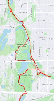
When nearby Theodore Wirth trails are closed the trail rides explore a surprising range of dirt options. I'm going to try to collect a few Strava Maps for posterity. The winter fat bike "bandit" trails are among my favorites -- even more than the superb trails at Theodore Wirth park.

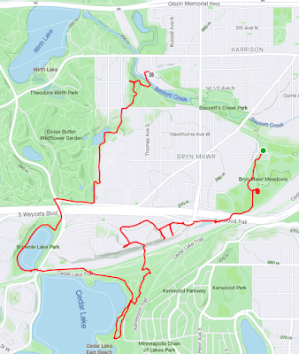
Summer ride along rails (click to enlarge) ...


There are some fun paths that go by a school in here. Cross a few rail lines.
The Cedar Lake East beach is a well known Bohemian beach (bare butt), I think there's one on the east side of Wirth Lake too but that's not for olds.

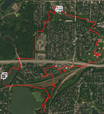
Variant of above but satellite view. 
The dense square is a skills park.
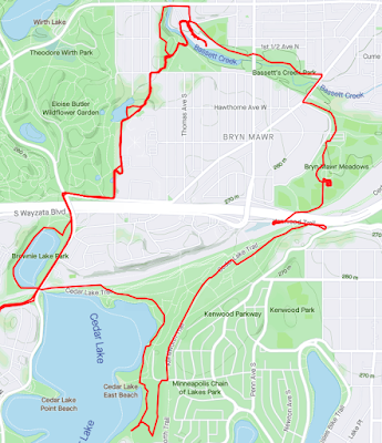
And slightly better choice

Saturday, December 25, 2021

All weather (but especially winter) cycling clothing guide (Wheel and Sprocket, with comments)

I came across this on Facebook, but I can't find it on the Wheel & Sprocket site. It's the best visual guide to cold weather clothing I've come across:


What would I add or change?
  • Poagies/bar mitts: If you have straight bars these are a game changer for below 30F. Between 30-40F they let me ride in thin gloves or even fingerless bike gloves.
  • You hardly ever need a "warm jacket". T-shirt + thermal base layer + a good quality wind shell (ideally GoreTex). Below 20F consider adding a down vest that you can take off when you get too hot.
  • You don't need a winter helmet, a balaclava and headband combo will do it.
  • You do need a neck gaiter. Brilliant invention. Mine is some thin synthetic from Outdoor Research.
  • Below 15F winter boots and wool socks may need chemical toe warmers or LiOn electric socks.

Friday, August 27, 2021

Eastern Metro Twin Cities: St Croix and Mississippi Rivers

Route

83 miles - leaves from Lake Phalen (Clockwise direction)

It's missing a 13 mile segment that Google doesn't know about, that map is below a few variations not his ride. I'll update this post with comments after it's done. (This is a improvement from an earlier version, I substituted Stagecoach Trail for 95 south of Stillwater and added Selma's Ice Cream. I'm continuing to tweak the Google Map but will update the image below.)


Some points of interest on route
  • Bruce Vento Nature Center
  • Selma's Ice Cream Parlor - 44°53'56.9"N 92°46'59.7"W
  • Velo du Nord  in Afton (Bike/Coffee shop. Also - French!)
  • St Croix Bluffs Regional Park - 44°48'03.6"N 92°47'34.4"W
  • Carpenter Nature Center (just south of the St Croix Bluffs Regional Park)
  • The park just west of Prescott is a great water refill station
  • Stillwater and Hastings
  • Afton Inn
  • St Paul & Spiral Brewing
  • Gasthaus Bavarian Hunter (Stillwater)
  • Rock Island Swing Bridge
  • Hmong Village
Tricky turns
  • Transition to Stagecoach Road after Highway 36. Run into Kings Plant Road and need to turn right onto 56th Street N that runs into Stagecoach Trail N then turn left.
Update after doing the tour
  • After crossing over 36 we didn't directly do Stagecoach, we took a park trail system that meets-up with Stagecoach, they aren't shown on Google Maps but I think they run through Valley View park
  • Stagecoach to Afton isn't bad though in places the speed limit is 55. There's often a wide shoulder and drivers are used to cyclists.
  • After Selma's in Afton instead of slowly climbing out on St Croix Trail S we took River Road S which is flat and pretty until it ends with a long steep climb. I prefer River Road S.
  • After Afton Alps St Croix Trail S is two lanes, no shoulder, 55 mph and pretty popular. 47/50 drivers were excellent but 3 were mediocre. (Motorbikes were all great.)
  • The Carpenter Nature Center is a great place to stop to eat what you are carrying, refill water bottles, and use the rest room. (Leave a donation.)
  • St Croix runs smack into Highway 10 which is a friggin highway with up to 4 lanes going 65-80 mph. The bike trail across the road is inaccessible from the intersection. The only way to cross Highway 10 is to wait for a break in traffic and run.
    • If you run across you can take the broad shoulder about 400 meters left (east) and you'll see the trail and can walk across some grass to it. OR (I think) you can walk 25 meters right (west) and there's a short dirt path that leads to the trail.
Misc advice


(this one isn't as optimized as the first version)


The gap at the bottom of both maps is a Google error -- there's actually a trail there. The gap is 13 miles, which takes the entire ride to 88-89 miles. A bit longer than my 80-85 mile target so I'm going to trim a few miles. It is mostly bicycle trail with a segment of 4 miles of road that may have industrial traffic during the week but is very quiet on weekends. Of those 4 miles about 2 miles are packed dirt and gravel but it is doable on any bicycle tire.


Variation from Charles S is very similar to first version, it shows the climbs and drops (not as bad as it looks). It's 83 miles.


Saturday, July 10, 2021

MacGroveland to Como Park (connects to Grand Rounds trail)

During the bad times highways completely messed up Saint Paul. We're still recovering; only recently have we developed some north-south routes that safely cross rail and freeway.

Below are two examples that go between Macalester college and Como Park pavilion. It's about a 4.7 mile trip each way. From Como there are now quite good Grand Rounds trails west and east to Gateway (Stillwater).

These routes use some bike-pedestrian walkways over rail and freeway that are barely visible on Google maps and omitted from most paper maps.

UPDATE: The 2nd route, which is basically Griggs all the way, is excellent. Do that.

https://goo.gl/maps/yZimkd6AR2GacRdSA


and

https://goo.gl/maps/QZEa1atwCTiLwsXN7 


(Snelling may be impossible to cross, so consider going up to St Claire or down to Jefferson just before you reach Snelling)


Friday, June 18, 2021

MSP Explorer - 15 miles

This route starts and ends at Lake Monster brewery. It explores some neat urban routes and spaces. Not many places to go fast, so allow 2 hours.

I have an 8 page map up as of June 2021 and a MapMyRide version but I can't guarantee it will stick around. Lake Monster to Dinkytown to Sheridan Memorial Park to East River Parkway to The Stone Arch Bridge to The Monument on Summit to Prior to Gilbert (CFSP) to Lake Monster.


Monday, May 31, 2021

Minneapolis to Sunrise Prairie (31 miles 1 way, but on to Duluth)

Via Facebook, AK shared a route from MPLS to Sunrise Prairie. At Sunrise Prairie one can start the trail to Duluth.

... It’s almost all bike lane/trail. The last big chunk that isn’t is all a county road but it has 10 ft shoulders ... Also, on Lake Rd, you go through Circle Pines which has a more populated section (but still has a big shoulder) but if you are uncomfortable with that, there is a frontage road you can ride on till you get to a less populated area...


 I also wonder about this as a route to Hugo, but I'm not sure we can get through Lino Lakes.


Saturday, May 29, 2021

Gravel rides around Northfield MN (south of MSP)

Bruce Anderson posted this 5/23/2021 on the Cannon Valley Velo Club Facebook Group. I'm just republishing here:

Want to ride gravel in the Northfield area? Look no further! Here’s a growing list of gravel routes of all lengths and levels of difficulty.

Rides are categorized below as:

• Easy (less than 20 miles, any amount of climbing*)

• Moderate (20 to 40 miles, any amount of climbing)

• Moderately Hard (30 to 40 miles with more than 1500 feet of climbing)

• Hard but Relatively Flat (more than 40 miles and less than an average of 30 feet of climbing per mile)

• Hard and Moderately Hilly (more than 40 miles and an average of 30 to 40 feet of climbing per mile)

• Hard and Hilly (more than 40 miles and an average of more than 40 feet of climbing per mile)

• Killer but You’re Gonna Love It Anyway (more than 100 miles and plenty of climbing)

*Climbing elevations are generally as reported by the RideWithGPS mapping tool. In the author’s experience, actual climbing as recorded on these routes by GPS is often significantly higher than the RWGPS estimates. 

You can, of course, double your options by riding any of these routes in reverse. If you would like to add your favorite route(s) to the list, please comment on this post and a moderator will edit the original post to include the route if it is deemed a good addition. 

Most routes start and end at Bridge Square in the heart of historic downtown Northfield. If they start or end elsewhere, there’s likely a brewery or something else inviting involved! (Three excellent breweries and a cidery are within a few blocks or miles of Bridge Square for post-ride refreshments: Imminent Brewing (two blocks away), Tanzenwald Brewing Company (0.3 miles), Chapel Brewing (3.1 miles), and Keepsake Cidery (6.1 miles).

Ride on!

Northfield Gravel Rides

Easy (less than 20 miles, any amount of climbing)

• Southwest, Return on East Cannon River Trail (14.3 miles, 406’ of climbing) https://ridewithgps.com/routes/27224078

• Cannon River Ramble 15-miler (15 miles, 438’ of climbing) https://ridewithgps.com/routes/27220502

• Northeast and Back on Sciota Trail (16 miles, 584’ of climbing) https://ridewithgps.com/routes/36130634 

• Isaacson Trail Quickie (16.8 miles, 606’ of climbing) https://ridewithgps.com/routes/27223989

• Cold Moon Howl (18.8 miles, 560’ of climbing) https://ridewithgps.com/routes/31572631

• Patrick L-Approved Loop (18.8 miles, 826’ of climbing, including a couple of challenging climbs) https://ridewithgps.com/routes/36132368

• Crow Moon Howl 20-miler (19.8 miles, 478’ of climbing) https://ridewithgps.com/routes/26943822

Moderate (20 to 40 miles with less than 1500’ of climbing)

• McKnight Prairie Fly-By (21.6 miles, 553’ of climbing) https://ridewithgps.com/routes/36130160

• Chub Lake Super Blue Moon Howl (24.3 miles, 650’ of climbing) https://ridewithgps.com/routes/26788958

• Easy Like Sunday Afternoon (27.7 miles, 633’ of climbing) https://ridewithgps.com/routes/26513582

• Burma Passage and Ghost Nike Missile Site (28.9 miles, 796’ of climbing) https://ridewithgps.com/routes/22064188

• Randolph -- Strachan Farm Loop (30.1 miles, 648’ of climbing) https://ridewithgps.com/routes/20009046

• Farmer Trail – Big Woods – Dennison (30.2 miles, 1078’ of climbing) https://ridewithgps.com/routes/36141468

• Western Gravel Staying East of I-35 (30.7 miles, 677’ of climbing) https://ridewithgps.com/routes/20830839

• Chub Lake Howl (30.7 miles, 792’ of climbing) https://ridewithgps.com/routes/25865282

• Burma Passage – Randolph (31.2 miles, 638’ of climbing) https://ridewithgps.com/routes/26439954

• Chub Lake – Burma Passage (31.4 miles, 765’ of climbing) https://ridewithgps.com/routes/26343685

• Boy Scout Camp Loop with Cherry Valley Descent (31.4 miles, 956’ of climbing) https://ridewithgps.com/routes/36138847

• Farmer Trail – Eiler Ave – Rice County Wilderness Area (32.3 miles, 1361’ of climbing) https://ridewithgps.com/routes/25382894

• 20th Ave Rollers (32.4 miles, 1496’ of climbing) https://ridewithgps.com/routes/36084642

• Beware Falling Mergansers (33.0 miles, 911’ of climbing) https://ridewithgps.com/routes/21606223

• Burma Passage – Chub Lake (33.5 miles, 893’ of climbing) https://ridewithgps.com/routes/25146470

• Lewiston Boulevard – Passage to Burma (34.3 miles, 726’ of climbing) https://ridewithgps.com/routes/32501103

• Circle Lake 36-Miler (36.2 miles, 1358’ of climbing) https://ridewithgps.com/routes/33841395

• Wilderness Park – Cannon City – Farmer Trail – Isaacson Trail (37.1 miles, 1308’ of climbing) https://ridewithgps.com/routes/32565532

Moderately Hard (30 to 40 miles with more than 1500’ of climbing)

• Westerly to Union Lake Trail and Baseline Road (30.4 miles, 1534’ of climbing) https://ridewithgps.com/routes/21780917

• Farmer Trail – Big Woods – Isaacson Trail (32.3 miles, 1786’ of climbing) https://ridewithgps.com/routes/30953952

• Beautiful Barn Loop; (37.9 miles, 1679’ of climbing) https://ridewithgps.com/routes/30207821

Hard but Relatively Flat (more than 40 miles and less than an average of 30 feet of climbing per mile)

• Camp Winona Trail – Union Lake Trail (52.1 miles, 1354’ of climbing) https://ridewithgps.com/routes/33318702

• Vermillion Highlands – Chimney Rock (63.2 miles, 1472’ of climbing) https://ridewithgps.com/routes/32497739

• Montgomery Calling (55.6 miles, 1580’ of climbing) https://ridewithgps.com/routes/29133208

Hard and Moderately Hilly (more than 40 miles and an average of 30 to 40 feet of climbing per mile)

• Full Strawberry Moon 42-Miler (42.5 miles, 1595’ of climbing) https://ridewithgps.com/routes/21924422

• Falls Trail – Union Lake Trail (43.0 miles, 1349’ of climbing) https://ridewithgps.com/routes/33318802

• Shady Lane Trail Pronto (44.7 miles, 1597’ of climbing) https://ridewithgps.com/routes/21733748

• Small Taste o’ the DAMn (48.1 miles, 1757’ of climbing) https://ridewithgps.com/routes/33586778

• Union Lake Trail – Cody Lake Trail – Lake Ave (49.7 miles, 1677’ of climbing) https://ridewithgps.com/routes/26519007

• Full Strawberry Moon Howl 50-miler (50.4 miles, 1875’ of climbing) https://ridewithgps.com/routes/21892498

• Clark Valley Trail – Byllesby Dam (52.5 miles, 1848’ of climbing) https://ridewithgps.com/routes/32424296

• Heywood 55 (53.3 miles, 1932’ of climbing) https://ridewithgps.com/routes/31947123

• Camp Winona Trail – Cody Trail – Union Lake Trail (57.2 miles, 1931’ of climbing) https://ridewithgps.com/routes/21082907

• Randolph – Chub Lake – Union Lake Trail Meander (58.9 miles, 2192’ of climbing) https://ridewithgps.com/routes/35721667

• Wilderness Park – Faribault – Monkey Valley (61.2 miles, 2215’ of climbing) https://ridewithgps.com/routes/32565083

• Shady Lane Trail – Monkey Valley 100k (62.3 miles, 2386’ of climbing) https://ridewithgps.com/routes/22740727

• Skunk Hollow – Clark Valley Metric Century (63.4 miles, 2311’ of climbing) https://ridewithgps.com/routes/32783148

• Shady Lane Trail – Wanamingo – Scenic Barn (63.7 miles, 2347’ of climbing) https://ridewithgps.com/routes/33676439

• Welch – Miesville Ravine – Randolph (78.0 miles, 2812’ of climbing) https://ridewithgps.com/routes/21505746

• Clark Valley Trail – Sunset Trail – Welch Trail – Miesville Ravine – Chimney Rock Loop (88.6 miles, 3171’ of climbing) https://ridewithgps.com/routes/21454059

Hard and Hilly (more than 40 miles and an average of more than 40 feet of climbing per mile)

• Monkey Valley – Nerstrand Big Woods (42.7 miles, 2037’ of climbing) 

https://ridewithgps.com/routes/33224111

• Shady Lane Trail – Scenic Barn (45.5 miles, 1833’ of climbing) https://ridewithgps.com/routes/28597969

• Earth Day Gravel Grinder (52.4 miles, 3048’ of climbing) https://ridewithgps.com/routes/32398440

• Wanamingo, No Foolin’ Around (57.5 miles, 2363’ of climbing) https://ridewithgps.com/routes/31466963

• Chimney Rock or Bust! (59.3 miles, 2492’ of climbing) https://ridewithgps.com/routes/31203805

• White Rock Trail – Oxford Mill Road (61.0 miles, 2890’ of climbing) https://ridewithgps.com/routes/30986263

• (Bit Longer) Taste o’ the DAMn (61.5 miles, 2468’ of climbing) https://ridewithgps.com/routes/33586723

• Area 57 with Return via Monkey Valley (66.0 miles, 2908’ of climbing) https://ridewithgps.com/routes/33223964

• Sunset Trail – Welch – Miesville Ravine – Byllesby Dam (71.9 miles, 3068’ of climbing) https://ridewithgps.com/routes/30727348

• Heywoodish Lite (76.9 miles, 3697’ of climbing) https://ridewithgps.com/routes/30136462

• Angry Catfish Comes to Town (82.6 miles, 3748’ of climbing) https://ridewithgps.com/routes/29263087

Killer but You’re Gonna Love It Anyway (more than 100 miles and plenty of climbing)

• Skunk Hollow -- Clark Valley -- White Rock – Vasa – Welch -- Miesville Ravine -- Chimney Rock Century (100.8 miles, 3894’ of climbing) https://ridewithgps.com/routes/32782960

• Camp Winona Trail-LeSueur-Montgomery Gravel Century (103.9 miles, 3103’ of climbing) https://ridewithgps.com/routes/20316984

• Thunder Moon Howl: Good Stuff to the West and East (105.5 miles, 5844’ of climbing) https://ridewithgps.com/routes/36141829

• Heywood 110 (109.9 miles, 5024’ of climbing) https://ridewithgps.com/routes/31947274

• It Ain’t Paradise but It Used to Be (127.6 miles, 5903’ of climbing) https://ridewithgps.com/routes/36141945

• Heywood 165 (163.8 miles, 7298’ of climbing) https://ridewithgps.com/routes/31948826