Sunday, January 20, 2013

Skijoring in Iron County Michigan and the Keweenaw: ABR Trails, the Mecca Ski Club and the KNSC Maasta Hiihto & Churning Rapids trails

Iron County falls within Lake Superior's snowbelt; once a reliable snow source. It's not what it once was, but when we visited it was working. The ABR Trails were excellent, though a week ago they'd been lousy.

There are at least two significant dog-friendly ski trails in Iron County, and a couple further west.

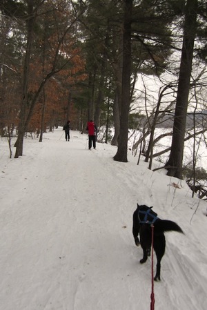
The ABR Trails are a commercial system about four miles south of Ironwood. The 70K+ trail system includes about 6 k of dog trails - Rascals Revenge, Spanky's Spill and Rudy's Shoot. We did them with our 3 kids and Kateva. The trails are labeled as “Expert", I'd call them "Eastern Intermediate". They are fully groomed for classic and skating. ABR charges $12 an adult, no fee for dogs.

The SkiMECCA trails is about 30 min south of Ironwood:

The MECCA Cross-Country Ski Trails are located in the town of Mercer, Wisconsin.  They run across a combination of State, County, Town, and private lands.  There are approximately 18 Km of trails groomed for classic and/or skate skiing.  Trails are groomed by volunteers, as conditions allow.  Hiking, snowshoeing, and dogs are allowed only on the untracked portions of the trails...

… The daily trail-use donation suggestions are $8 per adult, $5 per child, $1 per dog, or $20 for however many people you have in your car.

From the trail map I see that "untracked" means ungroomed or groomed for skating. That's quite a bit of this club maintained trail system.

Iron County has several other trails that may allow dogs. Twenty five years ago Porcupine State Park tolerated dogs on many trails, though that may have changed. The Uller and Montreal trails are remote and local practice may or may not allow dogs -- I haven't inquired.

Two hours further west in the Keeweenaw Swedetown does not allow any skijoring -- even on snowshoe trails. Happily, a reliable local source tells me dogs are toleratored or welcome on many Maasto Hiihto trails. The joy of these systems is that they welcome snowshoeing alongside the tracks, and apparently dogs fall into the same category:

Keweenaw Nordic Ski Club (KNSC)

Maasto Hiihto, which means “cross country skiing” in Finnish, is a striding-only trail system that offers kilometer after kilometer of unsurpassed skiing on varied and scenic trails. The trail system connects with the Churning Rapids trails. The two systems contain about 25 kilometers of groomed trails (see the trail map for details)

Snowshoeing is encouraged; there are many single track trails to follow, or on the side of the ski trails, as long as snowshoes do not step on set ski tracks.

The scenery on these trails is exceptionally varied and often breathtaking. Highlights include vistas of Portage Lake, Ruby Marsh, Swedetown Creek, mature forests, and pleasant meadows.

Two trailheads provide access to Maasto Hiihto: one at the Chalet on the Houghton County fairgrounds, and the other at Tomasi Road near the Hancock city garage, north of Portage Health.

The noble KNSC periodically hosts a moonlight ski and bonfire starting at the Thomasi trail head and going to the "triangle," for a fire and roasted weenies. This is a 1st class organization! We haven't made it there yet but it's on our radar.

Update 1/21/2013:

The Wolverine Ski Club maintains a trail system that can be joined at the top of the Powderhorn Alpine resort or from parking near Ironwood.  A club spokesman tells me skijoring is fine on the snowshoe trail and “skijoring wouldn’t work on the Wolverine Trails during the popular times of day, but all of them are suitable during off peak hours, ie early morning or after 4 most days.".

Update 12/30/2015: More on Churning Rapids, Maasto Hiihto

This year my family is planning a late January visit to the Keweenaw. In the post-snow era it may be our last best hope for Nordic skiing.

Since I first published this post there’s now a dog-friendly segment of the Swedetown trails, but more importantly the very extensive, single track only, Churning Rapids, Maasto Hiihto are all open to dogs. Here’s the word on CR/MH from an insider, edited slightly. He was responding to my questions, but you can pretty much guess the questions from the responses so I’ll omit them:

1. Dogs are welcome at MH/CR, in harness, on lead, or free roaming but in control. Dog tracks in ski tracks are inevitable, go to a no-dogs trail if you can't handle it  
2. Poop tossed in woods is fine  
3. Dog etiquette - snarly dogs not appreciated  
4. Christensen trail head has plowed parking for 3-4 cars but better roads to Tomasi or Chalet trailheads and loads of plowed parking and probably less drive time.  
5. 4WD not need at parking lots as they are flat

He added some comments about other trails nearby:

6. MTU has one 1.5K wide ski trail great for ski-joring and another 7K of nice but not challenging single track where dogs are allowed. Tech posts that dogs must be leashed and I have occasionally seen a dog or two leashed. Foot traffic is allowed on those trails also but does not create any problem.
7. Last winter Swedetown's dog trail was terrible and short. I've been told it will improve this year; we'll see.
8. CR has some bc skiing, especially the bike trails but they aren't marked for winter use (ie infrequent trail blazes/markers if any except at intersections) and can be a challenge but I say go for it - you'll never get lost, just turn around and follow your trail back to the van (don't get lost in a storm, this doesn't work)  
9. Not sure about Copper Harbor trails and dogs  
10. Eagle Harbor has some nice trails and say nothing about dogs in the past. I take my dog on them as does a friend.

I’m quite excited about this trip. We’ll be making a generous donation at the trailhead of course.

Tuesday, January 1, 2013

William O'Brien State Park: Skijoring and family skiing

It's only documented in a sign posted on the park trail [2], but William O'Brien State Park (Google map - parking) has a skijoring trail.

IMG 0636  2013 01 01 at 13 52 41

That's not quite the only documentation in truth. If you phone the recording mentions a hiking/snowshoe trail that allows dogs. That's the trail we took on a cold January 1, and we had an excellent time.

The trail is mostly flat but there's an intermediate style descent down the broad closed-for-winter access road. Our daughter walked part of it, but she could have easily snow plowed it. Towards the bottom of the road is the hiking trail we followed, here it's shown on a part of the PDF map:

Screen Shot 2013 01 01 at 4 29 01 PM

Starting from the lodge follow the trail to the winter-closed road, ski down it looking for the hiking trail sign. Take the trail as shown here; it returns to the road. If the kids are tired take a shortcut back from the Riverside Group Camp site.

This is a multi-use trail with a lot of walkers, dogs and snowshoe use. In places it is quite packed down, but we really didn't have much trouble skiing it. There's usually softer snow and/or ski tracks at the trail margins. There's quite a bit of dog poop at the start (sigh! We carry our stuff out) but not further down.

The somewhat dull terrain is offset by lovely river views and pretty woods.

The park requires a DNR ski pass; we have two we bought online for the season. [1]

There are extensive groomed trails dogs can't go on, we hope to visit those soon. There are also fairly extensive hiking/snowshoe trails south of the park off Broadway avenue. We didn't visit those and don't know if they allow skijoring but I think they do. Call the park first to be sure. (See update below.)

 - fn -

[1]  The purchase process is awkward. I asked and was told they're going to try to get approval to store a PDF of the pass on smartphones to make it easier to carry.

[2] As of Jan 2014 this appears on the park map as well.

See also

Update Jan 20, 2014

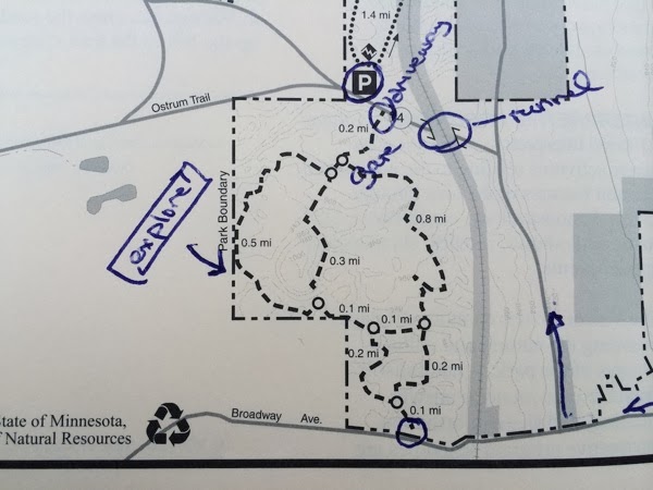
After another great skijoring outing on the short but fun hiking trail, we did some exploring of the mystery loop that shows on the William O'Brian map:

Explore

I was told by the Park ranger that this is a new acquisition that they haven't sorted out yet. As of Jan 2014 it's a hiking/snowshoe trail and we can skijor it. (Alas, that will probably change.)

It's hard to find. The "Broadway Ave" on the map is called "Maple" avenue where it meets 95 - directly east of the main entrance to Marine on St. Croix. (Maple is main street of Marine). Watch for signs for "Route 4", follow those through railway tunnel then look for parking on right. Today it was not plowed, only Subarus were parked. The lot is used for access to the Prairie Overlook Trail, but if you park there and walk a few meters west you can see a gate and a steep entrance to the hiking trails:

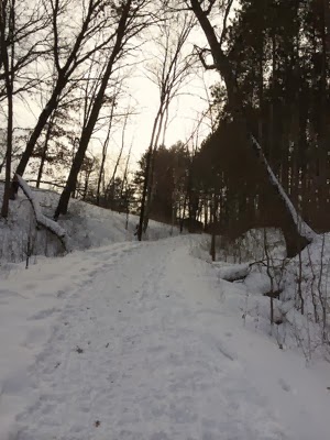
Trailhead

This isn't what most people want for skijoring, but it's awesome for us -- just what we love to ski. Looks like steep terrain, so be prepared to be good or to walk a bit. Trails are obviously well used and likely easy to navigate.

There's another entrance to the south off Broadway, but there's nowhere to park there.

If you go call ahead and ask if the lot is clear. If not you'll need a Subaru or equivalent -- or some shovels.

Update 2/17/14: We skied the Mystery trail today with Kateva, the skijor dog. It was horrible. Don't go there. Forget you ever heard about it. Bleak, dismal - it will drive you to drink. Just move along now...

Ok, I can't do it. I should, but I can't. It was the most fun we've had on a trail in years. Absolutely beautiful; though probably for intermediate skiers. My kids had no problems at all. Ungroomed of course, but on a snowy day just fabulous. We'll be back.

Monday, December 24, 2012

Cross-country skiing and skijoring: Minnesota DNR excels

There's something special about the Minnesota DNR. Wisconsin can't compare.

Three pages deserve particular attention

See also:

Wednesday, November 21, 2012

Lebanon Hills Mountain Biking

The Lebanon Hills trails are the crown jewels of MSP mountain biking. They are also, unsurprisingly, insanely popular.

References:

I've taken the kids there twice. Google doesn't seem to know where the trailhead is yet (I submitted an addition), but this link will take you to the West Trailhead and the Skills Park (Cliff road, Johny Cake, look for entrance).Screen Shot 2012 11 21 at 11 03 07 PM

The only negative of this astounding trail system is the traffic. The lot is usually full, and fast riders come from as far as Mankato and Rochester.  There is currently a problem with the novice trails - they get a lot of traffic from racers aiming for the faster trails. I'd like to see a way to either educate these riders to go extremely slowly on the green trails or to encourage them to bypass the novice trails. The press of fast riders can really discourage novice riders, esp. kids.

Otherwise my 10 yo daughter, who is far from bold, did very well on the Novice trail. She was anxious the first time and confident the second.

My 15yo hammered the blue trails, but we stayed away from the black and red. I have a hard fork bike (only one there!) and I suspect you want at least front suspension for the expert loops.

Theodore Wirth Park Mountain bike: The South Trail System (Enchanted Forest)

Theodore Wirth Mountain Biking trails are maintained by MOCA TRAILS. The kids and I rode the smaller south system, as shown on the MOCA map below.

For us, it was a poor choice. There is a 'novice' loop, but it's very short. The rest of the trail is not only intermediate+, but also quite short. Most of the trails are in the northern loop, but that has no novice trails I know of. We didn't visit it.

MOCA works hard to protect trails, but that means they can be unexpectedly closed -- even when conditions seem ideal. If you're going to visit this site, check trail status first by visiting the mocatrails.org site and looking for the trail condition icon on the main page.


TWMap

Monday, May 28, 2012

Bicycling Hastings MN and to Schaar's Bluff

While researching Spring Lake Park Reserve and Schaar's Bluff I came across the nearby Hastings bicycle trail map and a related Strib article. Looks like a good family outing, and perhaps inline skateble too (emphases mine) -- though the bridge detour and lack of future plans is worrisome ...

A cycling gem in Hastings | StarTribune.comJIM ADAMS 5/2011

... Hastings' scenic secret: A 12-mile-plus loop of bike trails that circles the river town. The bikeway crosses breathtaking Vermillion River gorges and ambles along the Mississippi banks in the historic downtown that once hosted a spiral bridge.

... The trail provides easy access to downtown restaurants and businesses that will make Hastings a biking destination once it hooks up to regional trail systems, Grilley said. Planning is underway on several fronts to connect it to larger systems, Bernstein said.

The most immediate is a 3.4-mile stretch that will carry Hastings bikers northwest to Schaar's Bluff for impressive views of ravines and river in the Spring Lake Regional Preserve ...  the county has bike trails running south from St. Paul almost to Rosemount. The two final legs are expected to be paved by 2015 to complete a 27-mile trail from Hastings to South St. Paul's northern border, he said.

The Nininger bluffs segment is the steepest hill in the loop. It carries bikers down and across a dike between Lake Rebecca and Spring Lake to Lock and Dam No. 2. Ducks and geese nest on the woodsy Lake Rebecca dike side, while bone-white driftwood washes up on the Spring Lake side, a Mississippi backwater. Red-winged blackbirds, bluebirds and herons flew past on an overcast day in mid-May.

At the Lock and Dam, the trail cuts south along the Mississippi, passing a park dock equipped with a free viewing scope.... ... availability of downtown restaurants and ice cream shops.

... Construction of the new Hwy. 61 bridge downtown has detoured cyclists away from the bike path that went under the existing bridge and will be rebuilt under the new bridge....

For now, the bridge detour brings bikers to Second Street, the main avenue along the river with dozens of historic storefronts. Turning north on Sibley Street returns you to the riverside trail. A nearby interpretive trail sign displays actual photos of the 1895 spiral bridge, sitting next to the present span that replaced it in 1951.

After several blocks, the path leaves the river and heads south past an old railroad station along Bailey Street to 8th Street. Bikers can continue south 10 blocks to the Vermillion River, or take a left on 8th, which becomes busy Ravenna Trail. The bike trail swings east for a short, optional loop near Lake Isabelle, then follows a narrow Ravenna shoulder a few blocks to a trail sign. It points up a short hill into woodsy C.P. Adams Park, which offers picnic tables for a lunch break, and a disc golf course for a weary-butt break (bring your own disc).

The trail inclines up past the Hastings Veterans Home and then crosses gorgeous gorges twice along the tree-lined Vermillion River. After crossing over a wooden bridge, the trail leads to a walking path along the south bank cliff that overlooks the 35-foot-tall Vermillion Falls.

The falls powered a flour mill, built in the 1850s and now owned by ConAgra Foods. Mill stone and brick walls tower above the falls on the north bank. The trail passes under Hwy. 61 by ConAgra and follows the Vermillion west past farms along County Road 46 for more than a mile to Pleasant Drive. The loop's longest -- though gradual -- hills arise going northwest up to General Sieben Drive across Hwy. 55, and eventually back to Niinger Road.

Because it has few steep hills, the loop is popular with families and senior groups, Bernstein said. The trail makes a nice morning ride, he said, after which some families buy tickets to the city's public pool for an afternoon swim.

I'd like to know how much might be inline friendly and how bad the bridge detour problem is.

Update: This is a good reference: Hasting Bridge Re-Design Brings New Multi-Use Path (2/2011). I've added that blog to my reading list.

Update 2: A friend passes on a trail report:

... the trail going from Schaars Bluff to downtown Hastings is smooth and inline friendly IF one is comfortable with the hills and crossing traffic frequently (because the trail isn't connected very well). There are also two portions closer to the Schaars Bluff end where the trail crosses gravel. The trails going through town are also smooth enough for inline, but again there are several crossings where the trail doesn't connect....

According to my friend, the bridge construction affects a small portion, about two blocks, in downtown. The best, least busy portions of the trail go from the river parking by the boat launch up to Schaars Bluff and wouldn't cross the construction. Where to park would depend on whether you would want to do the uphill on the 1st or 2nd half of the trip.

Update 3: If you ask nicely, Google will show the route. This is what we took:

Spring Lake Schaars Bruff Hastings Chocolate Creative Confectionaire

It's downhill from Schaar's Bluff to our ice cream stop  I highly recommend Creative Confectionaire on 216 E 2nd street  If it's not too warm buy some chocolate for the one you love. The turnoff from the main trail to lock and dam #2 is VERY easy to miss. Helps to have map on your phone. It's not really marked. If you're on the river side of the road take the first left trail turn.

The trail is generally very smooth. Fine for inline, albeit steep for many in Spring Lake Park. The only bit I didn't like was the path along a dike leading to the lock. It's fine for adults, but if you have an accident prone child there's a terrifying rock strewn drop on the upstream side. I was grinding my teeth watching my accident prone son bike along, yelling at him to stay in the middle of the trail.

The 61 bridge is under construction, but the bike/pedestrian detour is no trouble.

Update 7/7/2013: The trail is little changed, even though the new bike is in place. The minor detours will probably be gone next year. Sad news though -- the main street ice cream shop, Creative Confectionaire, has moved (and may be out of the ice cream business)! I was shocked, it seemed to be doing well.

Spring Lake Park Reserve and Schaar's Bluff - tiny cross-country trail system

I've never heard of this trail south of MSP, but from the summer trail map and winter trail map and a friends report it might be a nice family outing if there's snow (not too likely this epoch):

Spring Lake Park Reserve - Mississippi National River & Recreation Area 
Spring Lake Park Reserve offers over 3 miles of cross-country classic ski trails and almost 2 miles of cross-country skate-ski trails.

Spring Lake Park is a little known Dakota County/State park system a few miles from Hastings MN. The shoreline is still private; from the satellite map it looks like there's some kind of logging going on in part of it (!). I get the feeling the owners would not welcome tourists.

The Park area is associated with Schaar's Bluff Gathering Center, an attractive event place for weddings, meetings and the like. It has the look of a congressional earmark. I don't think it's available for use during routine ski days (too bad), but one year they had a Jan ski event there.

Here's the Google Map view, and here's a good looking bicycle or skate option to ice cream in Hastings.


View Larger Map

See also: