Normally I’d put this on our Highland Park Mountain Biking wiki, but wikispaces image upload is failing today. So sharing it here.
Our team routinely meets at a scenic overlook with an almost-hidden mountain bike trail that descends into the park system (from the far top left of the map below). But what if the trails are wet?
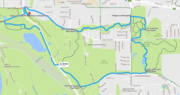
As show above there are good alternative routes.
From the scenic overlook go to Burns Avenue then Upper Afton Road to Battle Creek and follow the paved trails. The baseline 7.7 mile route is captured in this Google Map: goo.gl/maps/6yVgkxtFEJM2:

There are many options to take here to make the loops shorter or longer. If you compare these two images you see turf trails that may be open when mountain bike trails are closed, opportunities to do multiple loops and so on. If leading a group you it’s good to have some meetup areas.
